


Preview
Contributing Institution
Maine Geological Survey
Document Type
Image
Identifier
90987
Description
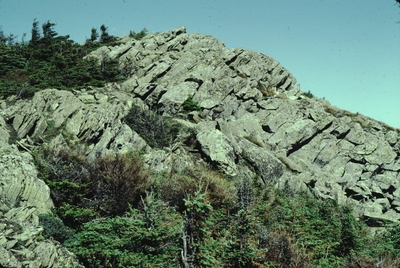
Gabbro dike (dipping from center top to center right) parallels beds in the Frontenac Formation near the summit of Boundary Bald Mountain
Project Name: Marvinney Historical Photos
Exact Creation Date
7-16-1981
Location
Bald Mountain Twp T4 R3
Supplemental Rights
Credit must be given to the photographer and the Maine Geological Survey when this photo is displayed, reproduced, distributed and/or used in derivative works.
Keywords
gabbro sill; Frontenac Formation; Silurian; Boundary Bald Mountain