


Preview
Contributing Institution
Maine Geological Survey
Document Type
Image
Identifier
72152
Description
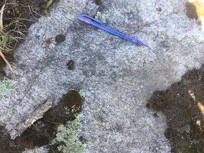
Photo 1: View down on a flat outcrop surface of the No Name Pond Granite (DSnn). The parallel alignment of biotite (foliation) in this photo is oriented roughly parallel to the pencil. South of Lane Road, Greene.
Project Name: STATEMAP Lake Auburn East Bedrock24k
Exact Creation Date
7-13-2022
Location
Greene
Supplemental Rights
Credit must be given to the photographer and the Maine Geological Survey when this photo is displayed, reproduced, distributed and/or used in derivative works.
Keywords
bedrock mapping; outcrop; STATEMAP; Lake Auburn East