


Preview
Contributing Institution
Maine Geological Survey
Document Type
Image
Identifier
72122
Description
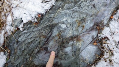
Photo 8: Gray cherty fine tuff, Ingalls Brook Road Formation (Oibrt).
Project Name: STATEMAP Chase Lake Bedrock24k
Location
T9 R10 WELS
Supplemental Rights
Credit must be given to the photographer and the Maine Geological Survey when this photo is displayed, reproduced, distributed and/or used in derivative works.
Keywords
bedrock mapping; outcrop; STATEMAP; Chase Lake