


Preview
Contributing Institution
Maine Geological Survey
Document Type
Image
Identifier
72111
Description
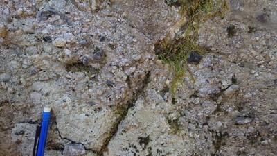
Photo 6: Poorly sorted tuffaceous lapillus conglomerate dominated by gray and dark gray cherty fine tuff pebbles or granules, some of which are rounded or near rounded. The layer is intercalated within tuff. Churchill Ridge Formation tuff (Scrt).
Project Name: STATEMAP Spider Lake Bedrock24k
Location
T10 R12 WELS
Supplemental Rights
Credit must be given to the photographer and the Maine Geological Survey when this photo is displayed, reproduced, distributed and/or used in derivative works.
Keywords
bedrock mapping; outcrop; STATEMAP; Spider Lake