


Preview
Contributing Institution
Maine Geological Survey
Document Type
Image
Identifier
72107
Description
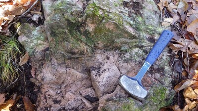
Photo 2: Rhyolite with flow bands, Churchill Ridge Formation (Scrr).
Project Name: STATEMAP Spider Lake Bedrock24k
Location
T10 R11 WELS
Supplemental Rights
Credit must be given to the photographer and the Maine Geological Survey when this photo is displayed, reproduced, distributed and/or used in derivative works.
Keywords
bedrock mapping; outcrop; STATEMAP; Spider Lake