


Preview
Contributing Institution
Maine Geological Survey
Document Type
Image
Identifier
70565
Description
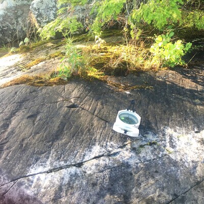
Glacial striations (deeper grooves parallel to compass) on a bedrock shoreline of Salmon Lake/Ellis Pond show that glacial ice flow was to the southeast. Additional irregular scratches and gouges on this outcrop were likely caused by lake ice abrasion throughout the Holocene.
Project Name: STATEMAP Rome Surficial
Exact Creation Date
9-7-2022
Location
Oakland
Supplemental Rights
Credit must be given to the photographer and the Maine Geological Survey when this photo is displayed, reproduced, distributed and/or used in derivative works.
Keywords
STATEMAP; surficial geology; Rome quadrangle; glacial striations; Salmon Lake; Ellis Pond