


Preview
Contributing Institution
Maine Geological Survey
Document Type
Image
Identifier
70561
Description
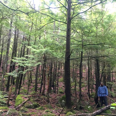
Lidar topographic imagery has made it easier to identify glacial landforms hidden under forest cover such as this former glacial meltwater channel. This boulder-armored valley was occupied by torrents of meltwater at the end of the last Ice Age, so it looks similar to a modern stream channel but is now dry.
Project Name: STATEMAP Belgrade Lakes Surficial
Exact Creation Date
6-12-2022
Location
Rome
Supplemental Rights
Credit must be given to the photographer and the Maine Geological Survey when this photo is displayed, reproduced, distributed and/or used in derivative works.
Keywords
STATEMAP; surficial geology; Belgrade Lakes quadrangle; meltwater channel; Kennebec Highlands