


Preview
Contributing Institution
Maine Geological Survey
Document Type
Image
Identifier
70498
Description
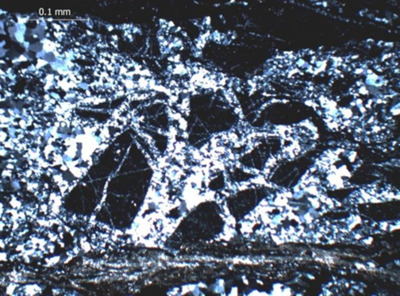
Figure 29 (continued). Northwest Boundary Fault: C, D-Western edge of Greenfield quadrangle. Photomicrographs showing brecciation of Vassalboro sandstones and mudstones. (C) O polarizers showing brittle deformation. (D), X polars showing recrystallization of quartz veins and matrix.
Project Name: Bedrock Geology 24k Greenfield
Location
Greenfield Twp
Supplemental Rights
Credit must be given to the photographer and the Maine Geological Survey when this photo is displayed, reproduced, distributed and/or used in derivative works.
Keywords
bedrock mapping; Greenfield quadrangle