


Preview
Contributing Institution
Maine Geological Survey
Document Type
Image
Identifier
70496
Description
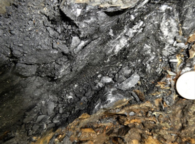
Figure 29. Northwest Boundary Fault: A, B- Sunkhaze Stream in SE corner of Olamon quadrangle. (A) Overview showing fault breccia and quartz veins adjacent to broken Vassalboro Group sandstone; (B) Closeup of brittlely sheared manganiferous Greenfield member and fragmented quartz veins.
Project Name: Bedrock Geology 24k Greenfield
Supplemental Rights
Credit must be given to the photographer and the Maine Geological Survey when this photo is displayed, reproduced, distributed and/or used in derivative works.
Keywords
bedrock mapping; Greenfield quadrangle