


Preview
Contributing Institution
Maine Geological Survey
Document Type
Image
Identifier
70479
Description
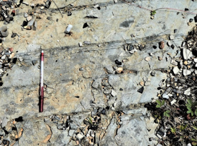
Figure 22. Medium and thick-bedded County Road Formation turbidites. (A) Greenfield quadrangle (SW corner) Sunkhaze Stream; (B-D) Otter Chain Ponds quadrangle.
Project Name: Bedrock Geology 24k Greenfield
Supplemental Rights
Credit must be given to the photographer and the Maine Geological Survey when this photo is displayed, reproduced, distributed and/or used in derivative works.
Keywords
bedrock mapping; Greenfield quadrangle