


Preview
Contributing Institution
Maine Geological Survey
Document Type
Image
Identifier
70467
Description
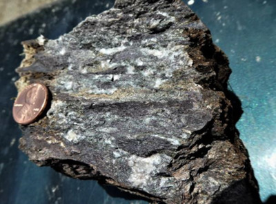
Figure 16. Mafic crystal-lithic tuff with dark red mudstone fragments and large volumes of calcite, interpreted as a pépérite. Along Stud Mill Road in Otter Chain Ponds quadrangle.
Project Name: Bedrock Geology 24k Greenfield
Supplemental Rights
Credit must be given to the photographer and the Maine Geological Survey when this photo is displayed, reproduced, distributed and/or used in derivative works.
Keywords
bedrock mapping; Greenfield quadrangle