


Preview
Contributing Institution
Maine Geological Survey
Document Type
Image
Identifier
70441
Description
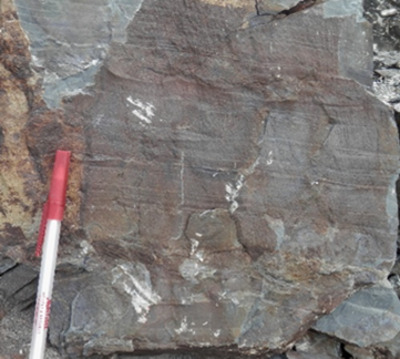
Figure 7. Lazy Ledges Road member, Baskahegan Lake Formation (See Plate 1 for photo locations). (A) Tightly folded thinly bedded sandstone and siltstone, displaying typical chalky weathering. (B, C) Fresh surfaces showing variable bed thickness
Project Name: Bedrock Geology 24k Greenfield
Location
Greenfield Twp
Supplemental Rights
Credit must be given to the photographer and the Maine Geological Survey when this photo is displayed, reproduced, distributed and/or used in derivative works.
Keywords
bedrock mapping; Greenfield quadrangle