


Preview
Contributing Institution
Maine Geological Survey
Document Type
Image
Identifier
67562
Description
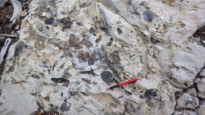
Photo 6: Erosional surface filled with poorly sorted pebbles of sandstone, siltstone, and mudstone in the Mud Pond Sandstone of the Seboomook Group (Dsmp).
Project Name: STATEMAP Carr Pond Bedrock24k
Exact Creation Date
7-2-2021
Supplemental Rights
Credit must be given to the photographer and the Maine Geological Survey when this photo is displayed, reproduced, distributed and/or used in derivative works.
Keywords
bedrock mapping; outcrop; STATEMAP; Carr Pond