


Preview
Contributing Institution
Maine Geological Survey
Document Type
Image
Identifier
21434
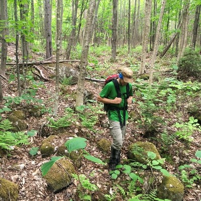
Description
Moss-covered cobbles and boulders mark a dry channel that was once the path of a glacial meltwater stream. Evidence of former glacial meltwater channels is plentiful in the Puzzle Mountain quadrangle, with many paths revealed by lidar topographic data.
Project Name: STATEMAP Puzzle Mountain Surficial
Location
Andover
Supplemental Rights
Credit must be given to the photographer and the Maine Geological Survey when this photo is displayed, reproduced, distributed and/or used in derivative works.
Keywords
glacial meltwater channel; Puzzle Mountain Surficial Geology Figure 7