


Preview
Contributing Institution
Maine Geological Survey
Document Type
Image
Identifier
21420
Description
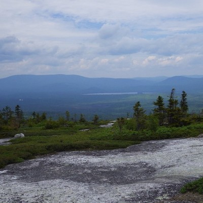
View of the Ellis Pond area looking north from Rumford Whitecap Mountain (East Andover quadrangle). Glacial erosion scoured the basin in which Ellis Pond now sits, also creating an ideal location for one of the first satellite communication stations: The Andover Earth Station became operational in 1962, but has been replaced by modern satellite dishes that are visible in the photo (white spot, mid-left).
Project Name: STATEMAP Ellis Pond Surficial
Location
Rumford
Supplemental Rights
Credit must be given to the photographer and the Maine Geological Survey when this photo is displayed, reproduced, distributed and/or used in derivative works.
Keywords
Ellis Pond; Roxbury Pond; Andover Earth Station; Rumford Whitecap; Ellis Pond Surficial Geology Figure 1