


Preview
Contributing Institution
Maine Geological Survey
Document Type
Image
Identifier
12443
Description
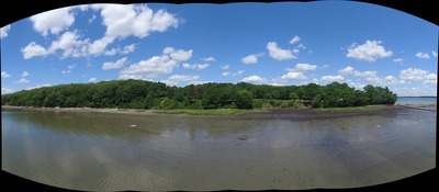
Panoramic from oblique drone images of bluffs at Flying Point, Freeport, ME
Exact Creation Date
6-30-2016
Location
Freeport
Supplemental Rights
Credit must be given to the photographer and the Maine Geological Survey when this photo is displayed, reproduced, distributed and/or used in derivative works.
Keywords
oblique imagery; bluffs; flying point; freeport