


Preview
Contributing Institution
Maine Geological Survey
Document Type
Image
Identifier
58332
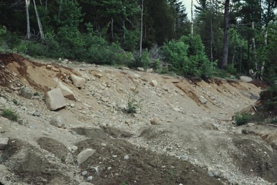
Description
Marine raised-beach and shoreline gravel, SW side of Indian Hill, N of Cross Road, Marshfield. Surveyed elevation of paleo shoreline = 190 ft.
Project Name: Thompson NGGDPP Grant 2020
Exact Creation Date
1-1-1982
Location
Machias
Supplemental Rights
Credit must be given to the photographer and the Maine Geological Survey when this photo is displayed, reproduced, distributed and/or used in derivative works.
Keywords
marine raised shoreline; Marshfield; Washington County