


Preview
Contributing Institution
Maine Geological Survey
Document Type
Image
Identifier
58240
Description
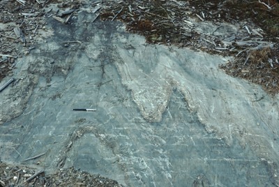
Folded bedrock exposed in glacial pavement next to logging rd., W of bridge across Cupsuptic Ri., Lower Cupsuptic (T4 R3). View to SW. Approximate location.
Project Name: Thompson NGGDPP Grant 2020
Exact Creation Date
9-1-1989
Location
Lower Cupsuptic Twp
Supplemental Rights
Credit must be given to the photographer and the Maine Geological Survey when this photo is displayed, reproduced, distributed and/or used in derivative works.
Keywords
bedrock fold structure; Lower Cupsuptic