


Preview
Contributing Institution
Maine Geological Survey
Document Type
Image
Identifier
58231
Description
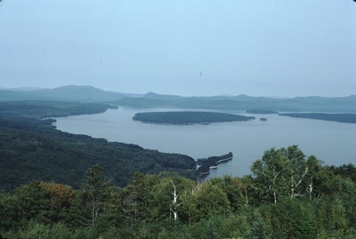
Mooselookmeguntic Lake from "Height of Land" on Rte. 17, Township D. View to NW. Note esker extending N into lake.
Project Name: Thompson NGGDPP Grant 2020
Exact Creation Date
9-1-1998
Location
Township D
Supplemental Rights
Credit must be given to the photographer and the Maine Geological Survey when this photo is displayed, reproduced, distributed and/or used in derivative works.
Keywords
Mooselookmeguntic Lake; esker