


Preview
Contributing Institution
Maine Geological Survey
Document Type
Image
Identifier
58211
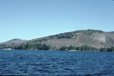
Description
5-N-21. Bryant Pond-SC. Looking NE across North Pond to Bucks Ledge from Rte. 26, showing asymmetric glacial erosional profiles of Bucks Ledge and bedrock islands in the pond.
Project Name: Thompson NGGDPP Grant 2020
Exact Creation Date
1-1-1984
Location
Greenwood
Supplemental Rights
Credit must be given to the photographer and the Maine Geological Survey when this photo is displayed, reproduced, distributed and/or used in derivative works.
Keywords
stoss and lee topography; Woodstock