


Preview
Contributing Institution
Maine Geological Survey
Document Type
Image
Identifier
54863
Description
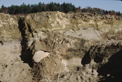
East Pittston-SE-88-58. Upper level of Rice Pit, proximal part of Palmer Hill delta, Whitefield, ME; shows till lenses and clasts in s+g. View to NNE.
Project Name: Thompson NGGDPP Grant 2020
Exact Creation Date
10-26-1988
Location
Whitefield
Supplemental Rights
Credit must be given to the photographer and the Maine Geological Survey when this photo is displayed, reproduced, distributed and/or used in derivative works.
Keywords
Glaciomarine deltas; Palmer Hill Delta; Whitefield