


Preview
Contributing Institution
Maine Geological Survey
Document Type
Image
Identifier
54457
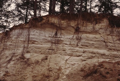
Description
North Waterford-SW-98-86. Cut on N side of dirt rd. across "The Plains", Lovell, showing Lake Pigwacket bottom sediments. View to NNW.
Project Name: Thompson NGGDPP Grant 2020
Exact Creation Date
11-19-1998
Location
Lovell
Supplemental Rights
Credit must be given to the photographer and the Maine Geological Survey when this photo is displayed, reproduced, distributed and/or used in derivative works.
Keywords
Lake Pigwacket; Lovell