


Preview
Contributing Institution
Maine Geological Survey
Document Type
Image
Identifier
54249
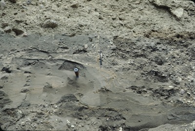
Description
4-C-16. Till over sheared sand and gravel, N of Ashland, in pit on W side of Rte. 11. Approx. location. New Brunswick Quaternary Association field trip.
Project Name: Thompson NGGDPP Grant 2020
Exact Creation Date
8-18-1982
Location
Ashland
Supplemental Rights
Credit must be given to the photographer and the Maine Geological Survey when this photo is displayed, reproduced, distributed and/or used in derivative works.
Keywords
readvance till over sand and gravel; Ashland; Aroostook County; New Brunswick Quaternary Association