


Preview
Contributing Institution
Maine Geological Survey
Document Type
Image
Identifier
54210
Description
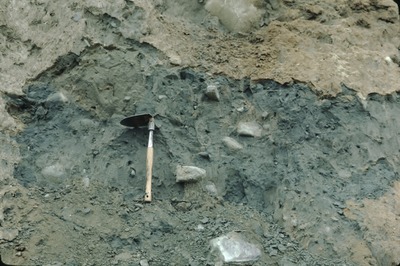
3-B-6. East Pittston-SE-80-26. Close-up of tlll mound beneath proximal part of Palmer Hill esker-delta, Potter's Pit, looking SW.
Project Name: Thompson NGGDPP Grant 2020
Exact Creation Date
10-16-1980
Location
Whitefield
Supplemental Rights
Credit must be given to the photographer and the Maine Geological Survey when this photo is displayed, reproduced, distributed and/or used in derivative works.
Keywords
till; Whitefield