

Preview
Contributing Institution
Maine State Archives
Document Type
StillImage
Identifier
04-337294-I036
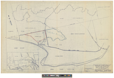
Description
Map of Township 3 Range 3 BKP WKR, Dead River, Shows Morgan Farm Survey with Long Falls Dam. Surveyed by NEPSCO Services,
Exact Creation Date
1949
Dimensions
22 x 34
Language
English
Keywords
Maine; Maps; Cartography