

Preview
Contributing Institution
Maine State Archives
Document Type
StillImage
Identifier
04-306013-I043
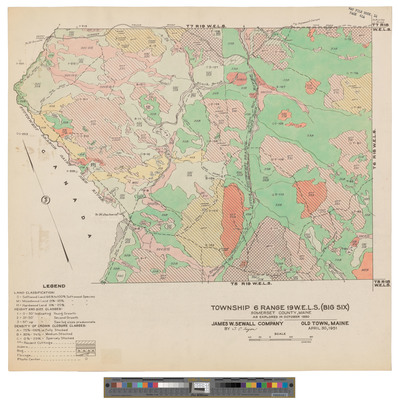
Description
Map of Township 6 Range 19 WELS, Big 6 Township. Shows forest type, roads, camps and telephone lines.
Exact Creation Date
1950
Dimensions
18.5 x 17.5 inches
Language
English
Keywords
Maine; Maps; Cartography