Home
Search
Browse State Agencies
My Account
About
Digital Commons Network™
Skip to main content
Home
About
FAQs
My Account
Home
>
StateDocs
>
sos
>
ARCHIVES
>
ARC_IMG
>
ARC_MAPS
>
MAPS_BY_COUNTY
>
MAPS_PENOBSCOT_COUNTY
Penobscot County
Printing is not supported at the primary Gallery Thumbnail page. Please first navigate to a specific Image before printing.
Follow
Switch View to List
View Slideshow
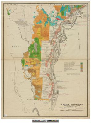
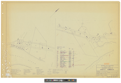
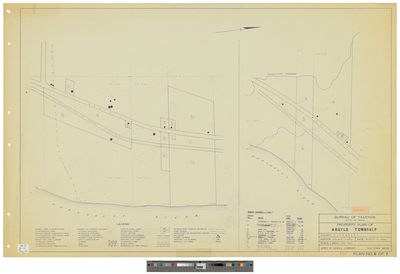
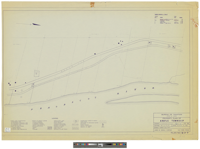
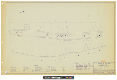
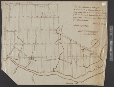
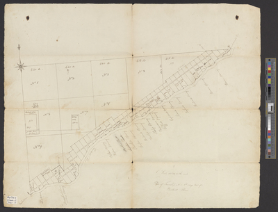
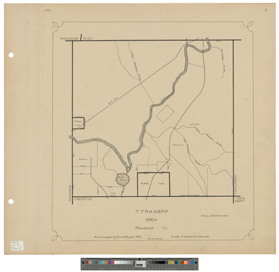
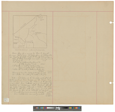
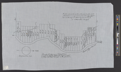
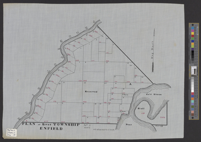
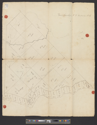
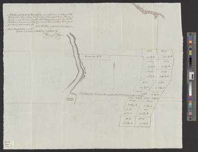
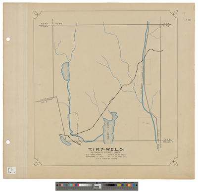
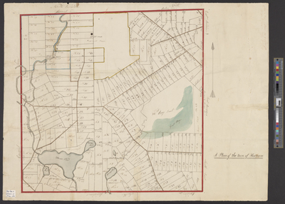
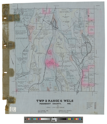
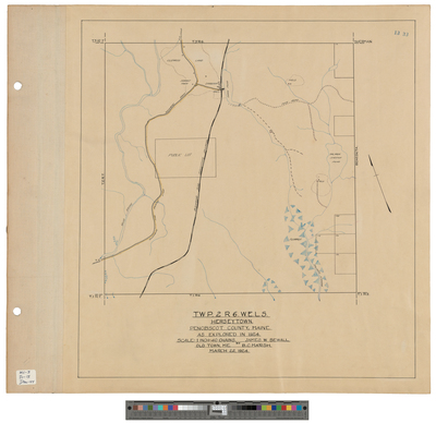
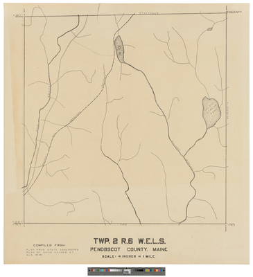
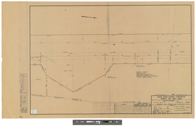
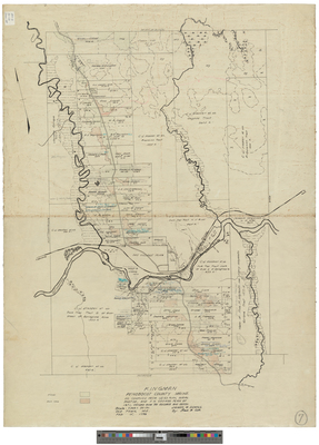
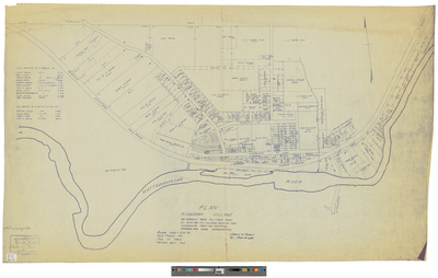
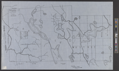
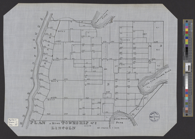
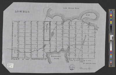
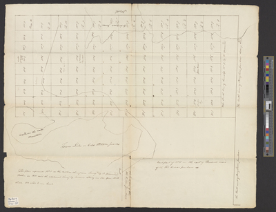
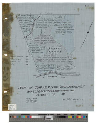
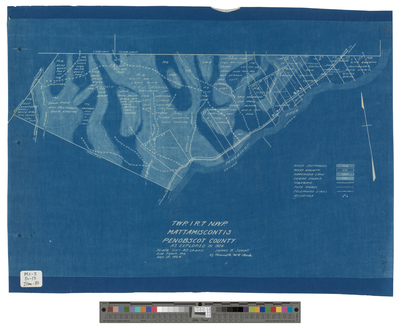
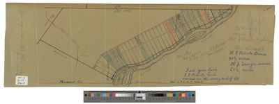
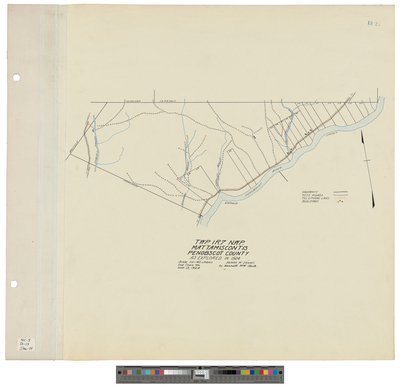
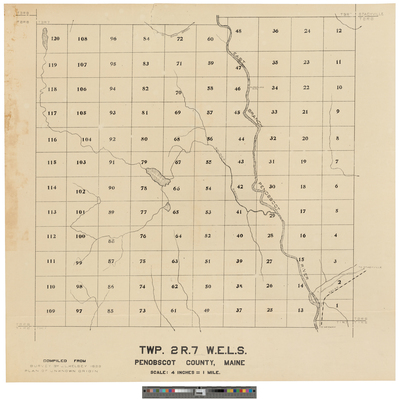
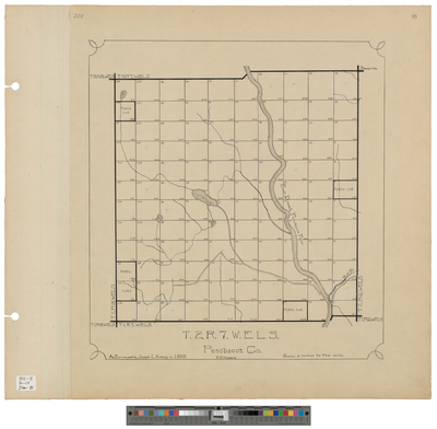
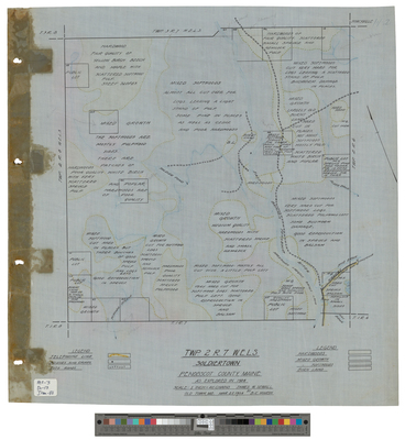
[Enfield]. River Township 1, East Side Penobscot River
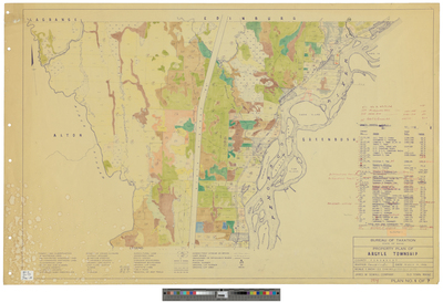
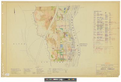
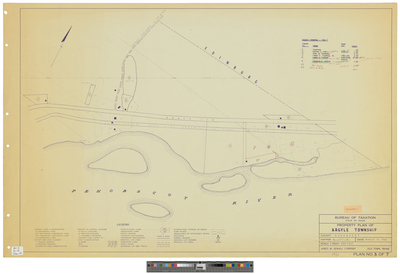
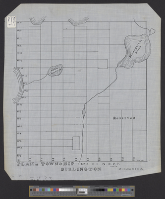
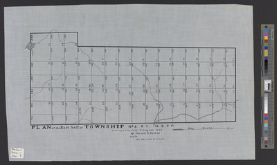
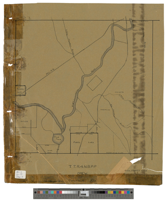
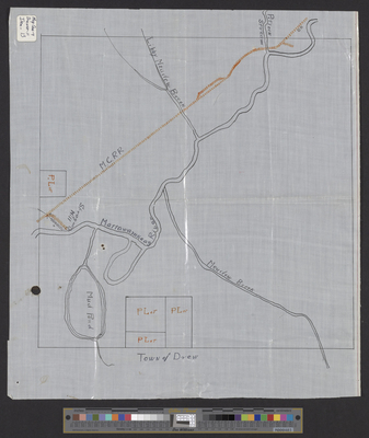
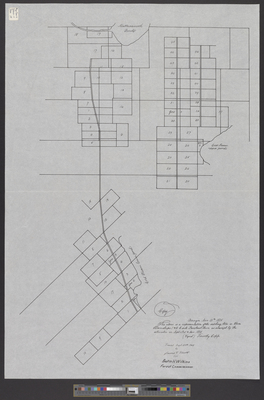
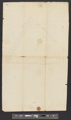
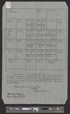
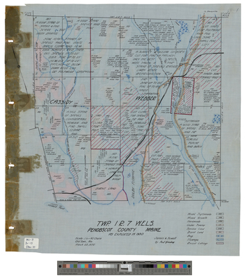
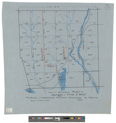
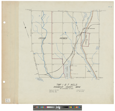
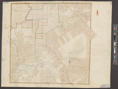
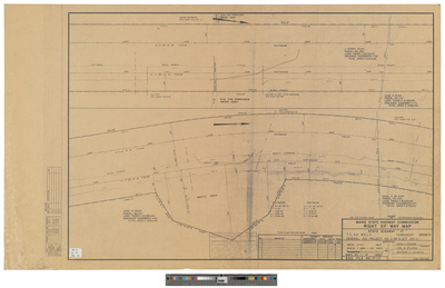
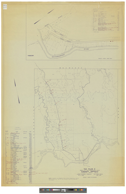
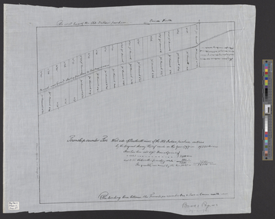
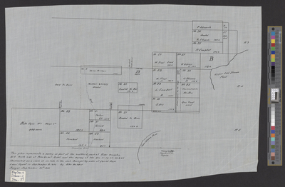
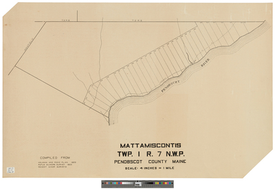
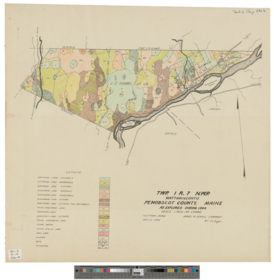
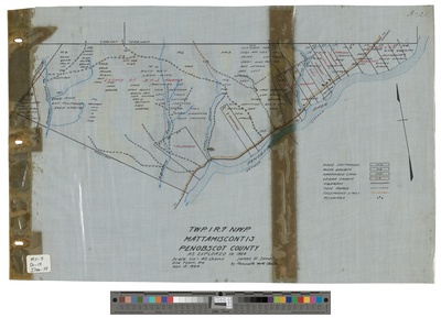
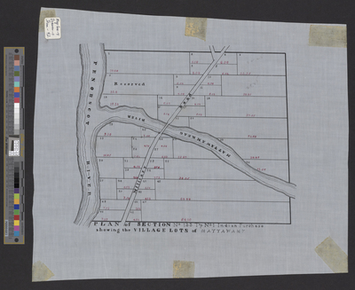
[Enfield]. Township 1.
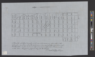
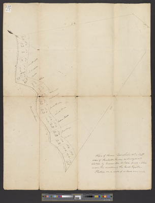
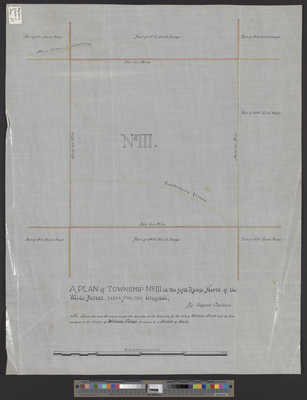
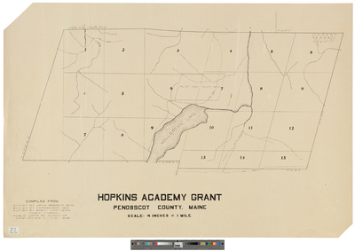
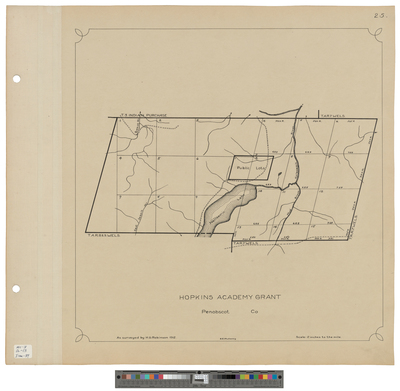
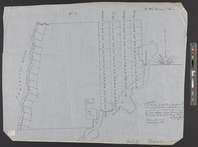
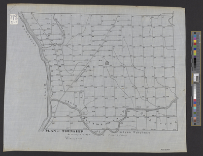
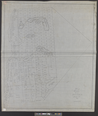
[Garland]. A Plan of Township 3 in the Fifth Range North of the Waldo Patent, Taken From the Original.
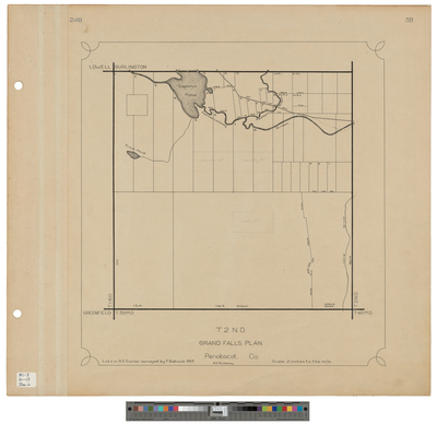
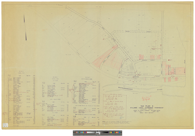
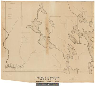
Grand Falls Plantation, T2 N.D.
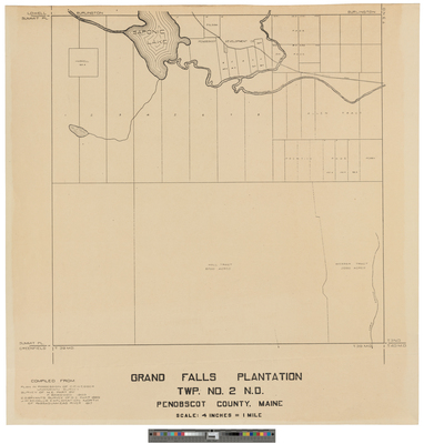
Grand Falls Plantation, TWP No. 2 N.D.
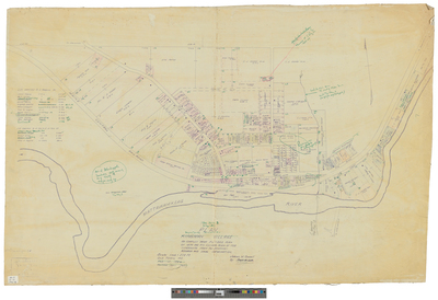
Grand Falls Southeast Corner lots, including B.B. Thatcher and Eastern Land Company
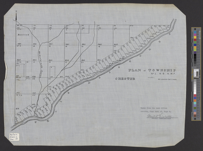
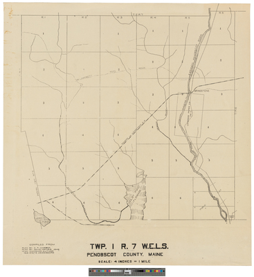
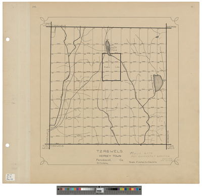
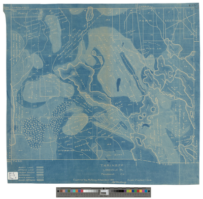
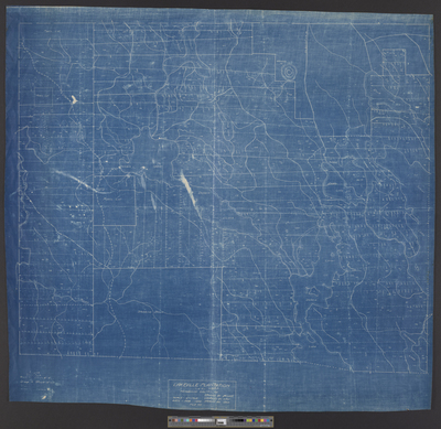
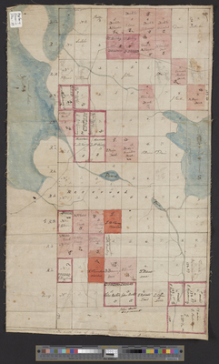
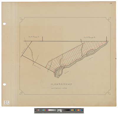
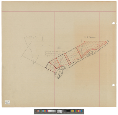
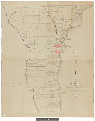
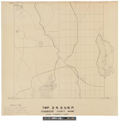
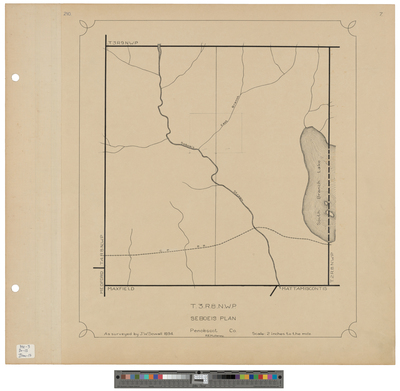
[Grand Falls]. Township 2 of the South Range, North Division
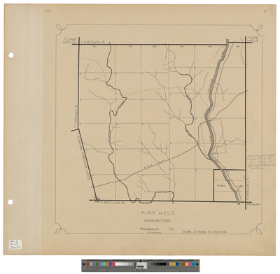
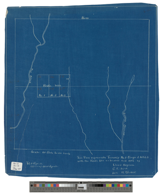
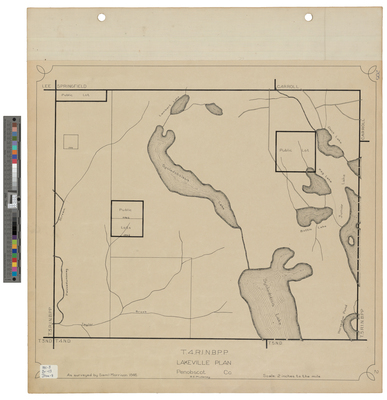
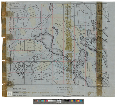
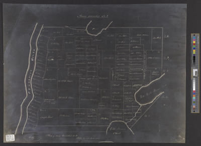
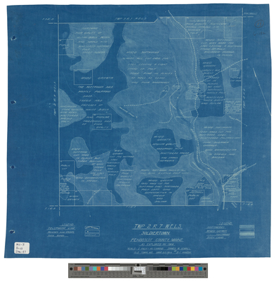
[Grand Falls Township] Township 11 of the South Range, North Division
Page
4
of
33
1
2
3
4
5
6
7
Search
Enter search terms:
Select context to search:
in this collection
Digital Maine
Advanced Search
Notify me via email or
RSS
Browse
State Agencies
Subjects
Contributors
For Agency Contributors
FAQs
Featured Links
Maine Government
Maine State Library
Maine State Agencies
Digital Maine Partners
Gallery Locations
View gallery on map
View gallery in Google Earth


![[Enfield]. River Township 1, East Side Penobscot River](https://digitalmaine.com/maps_penobscot_county/1230/thumbnail.jpg "[Enfield]. River Township 1, East Side Penobscot River")
![[Enfield]. Township 1.](https://digitalmaine.com/maps_penobscot_county/1231/thumbnail.jpg "[Enfield]. Township 1.")
![[Garland]. A Plan of Township 3 in the Fifth Range North of the Waldo Patent, Taken From the Original. by Osgood Carleton](https://digitalmaine.com/maps_penobscot_county/1234/thumbnail.jpg "[Garland]. A Plan of Township 3 in the Fifth Range North of the Waldo Patent, Taken From the Original. by Osgood Carleton")


![[Grand Falls]. Township 2 of the South Range, North Division by Rufus Putnam and James V. Elliott](https://digitalmaine.com/maps_penobscot_county/1235/thumbnail.jpg "[Grand Falls]. Township 2 of the South Range, North Division by Rufus Putnam and James V. Elliott")
![[Grand Falls Township] Township 11 of the South Range, North Division by Rufus Putnam](https://digitalmaine.com/maps_penobscot_county/1238/thumbnail.jpg "[Grand Falls Township] Township 11 of the South Range, North Division by Rufus Putnam")