

Preview
Contributing Institution
Maine State Archives
Document Type
StillImage
Identifier
4-308519-I043
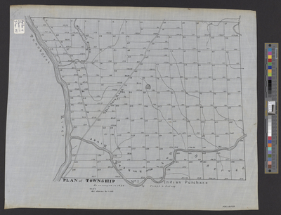
Description
Plan of Mattawamkeag (T1 Indian Purchase) as surveyed in 1834 by Joseph L. Kelsey on a scale of 40 chains to 1 inch.
Exact Creation Date
1834
Language
English
Location
Penobscot County; Mattawamkeag
Other Location
Mattawamkeag River; Penobscot River; Military Road; Madaceunk Stream
Keywords
Cartography; Maps; Surveys