

Preview
Contributing Institution
Maine State Archives
Document Type
StillImage
Identifier
4-308519-I022
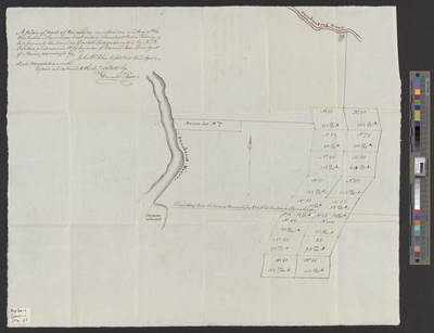
Description
A plan of a part of T1 and T2 OIP on the east side of the Penobscot River, lots formerly laid out in Gould's Ridge by R.B. Tarbox, and now in 1829 by order of Daniel Rose, Land Agent of Maine, resurveyed by John Webber, Assistant Land Agent.
Scale 100 rods to 1 inch.
Exact Creation Date
1829
Language
English
Location
Penobscot County; Greenbush
Other Location
Passadumkeag River; Olemon Island
Keywords
Cartography; Maps; Surveys