

Preview
Contributing Institution
Maine State Archives
Document Type
StillImage
Identifier
4-361695-I011
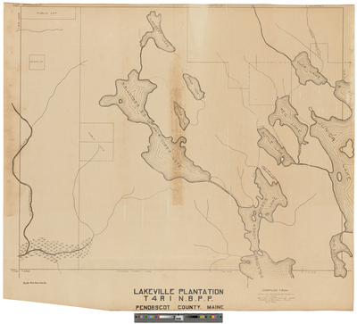
Description
Plan of Lakeville Plantation, T4 R1 NBPP compiled from Zebulon Bradley's survey of 1832, and Samuel Morrison's survey of 1846.
Scale 4 inches to 1 mile.
Exact Creation Date
1916
Language
English
Location
Penobscot County; Lakeville
Other Location
Taylor Brook; Passadumkeag River; Sisladobsis Lake; Bottle Lake; Duck Lake; Keg Lake; Junior Lake; Upper and Lower Pug;
Keywords
Cartography; Maps; Surveys