Home
Search
Browse State Agencies
My Account
About
Digital Commons Network™
Skip to main content
Home
About
FAQs
My Account
Home
>
StateDocs
>
sos
>
ARCHIVES
>
ARC_IMG
>
ARC_MAPS
>
ATLASES
>
ATLAS_SOMERSET_1883
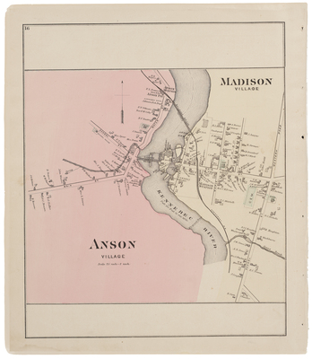
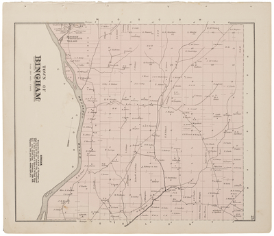
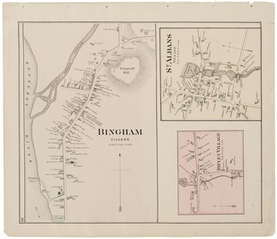
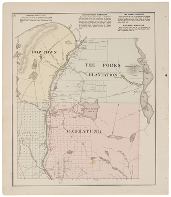
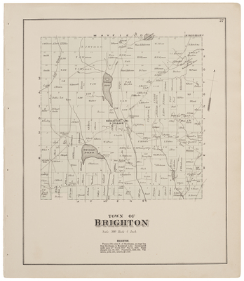
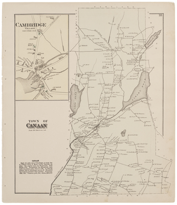
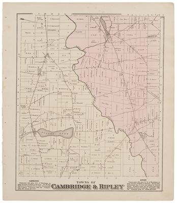
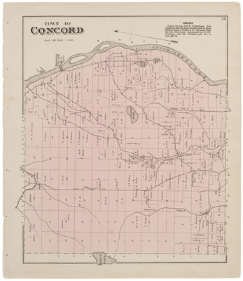
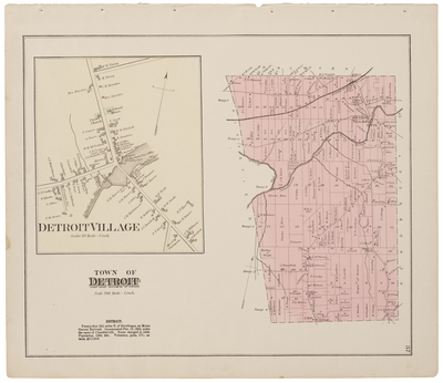
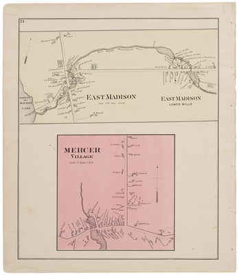
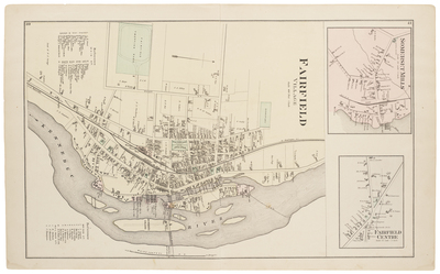
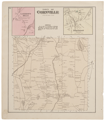
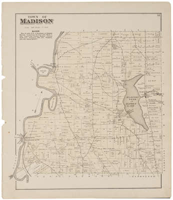
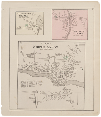
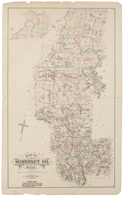
Somerset County
Map of Somerset Co., Maine. Published by Geo. N. Colby & Co., Houlton, ME.
Printing is not supported at the primary Gallery Thumbnail page. Please first navigate to a specific Image before printing.
Follow
Switch View to List
View Slideshow
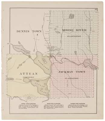
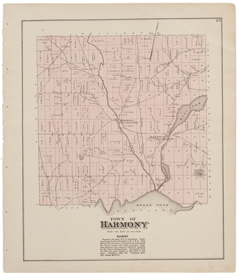
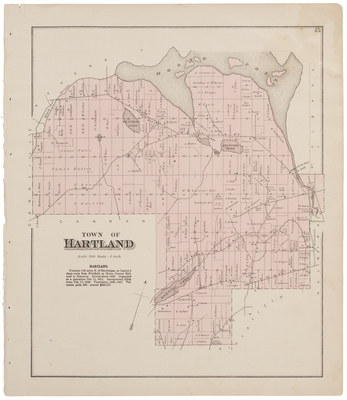
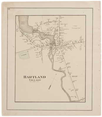
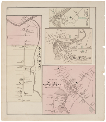
Moose River Village, East New Portland, New Portland (West New Portland) & North New Portland
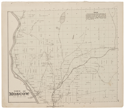
Moscow
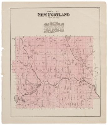
New Portland
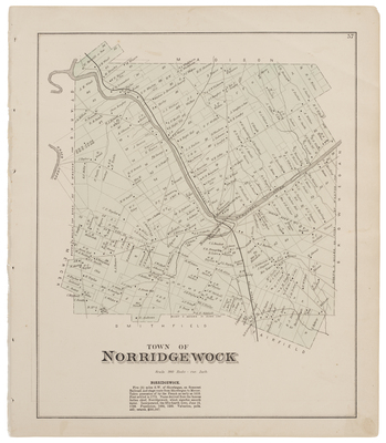
Norridgewock
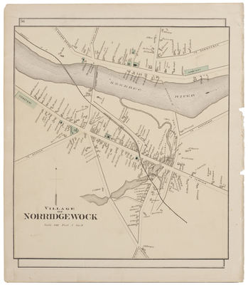
Norridgewock
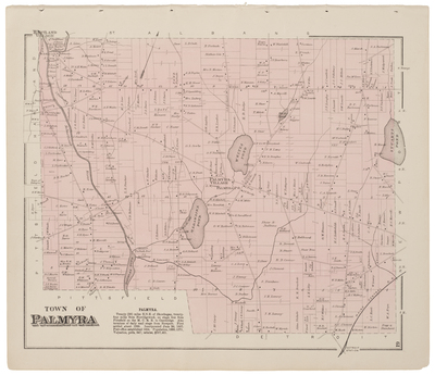
Palmyra
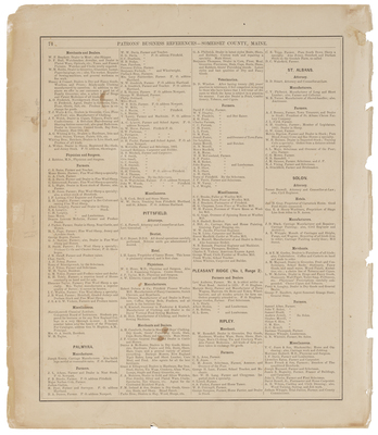
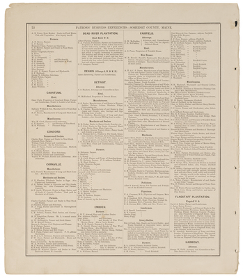
Patrons' Business References
Patrons' Business References
Patrons' Business References
Patrons' Business References
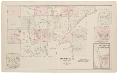
Pierce Pond, Sapling town, Misery town, Parlin Pond, The Forks of the Kennebec River, Carrying Place Town, Sandy Bay Town
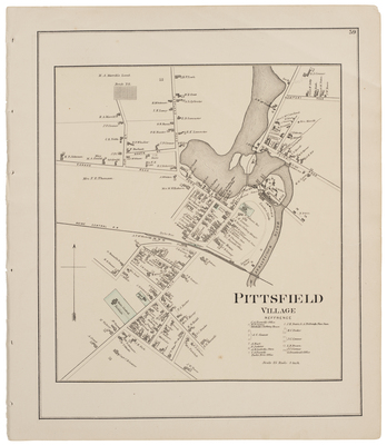
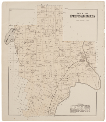
Pittsfield
Pittsfield
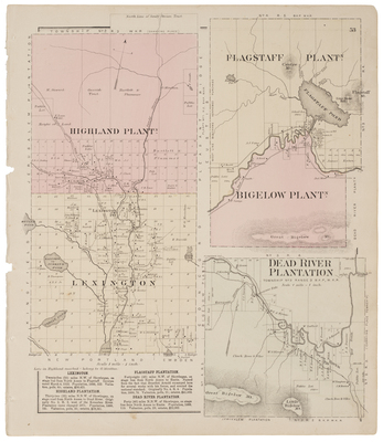
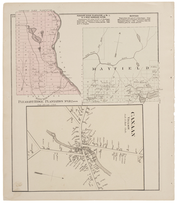
Pleasant Ridge Plantation, Canaan & Mayfield
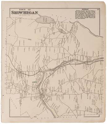
Skowhegan
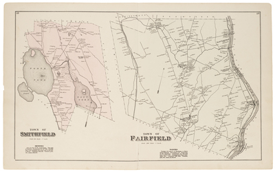
Smithfield & Fairfield
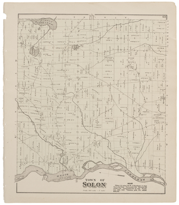
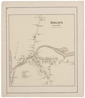
Solon
Solon
St. Albans
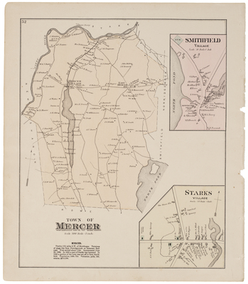
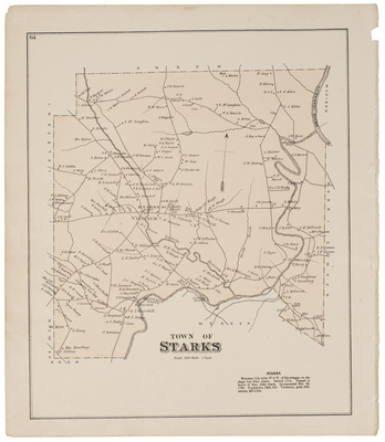
Starks
Table of contents, Towns, villages, plantations, wild lands
Timber Lands plan #1, Holeb Town, Carrying Place, Sandy Bay, East Moxie, Square Town
Timber lands plan #2, Taunton and Raynham Academy Grants, Sandwich Academy Grants, Seeboomook, Long Pond, Tomhegan,Thorndike, W Township
1
2
Search
Enter search terms:
Select context to search:
in this collection
Digital Maine
Advanced Search
Notify me via email or
RSS
Browse
State Agencies
Subjects
Contributors
For Agency Contributors
FAQs
Featured Links
Maine Government
Maine State Library
Maine State Agencies
Digital Maine Partners
Gallery Locations
View gallery on map
View gallery in Google Earth


 & North New Portland")


