Home
Search
Browse State Agencies
My Account
About
Digital Commons Network™
Skip to main content
Home
About
FAQs
My Account
Home
>
StateDocs
>
sos
>
ARCHIVES
>
ARC_IMG
>
ARC_MAPS
>
ATLASES
>
ATLAS_SOMERSET_1883
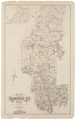
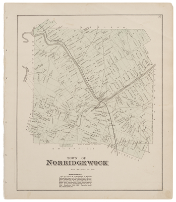
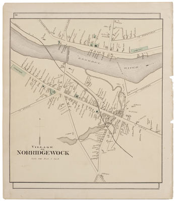
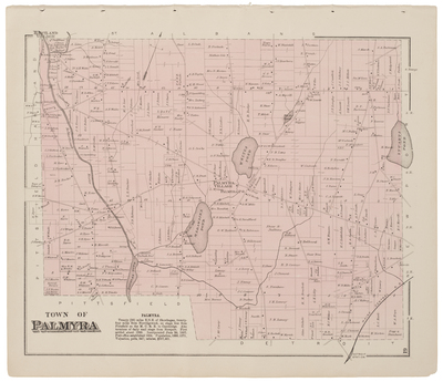
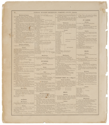
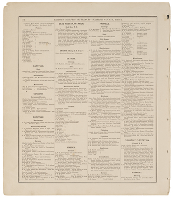
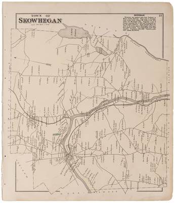
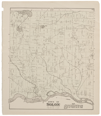
Somerset County
Map of Somerset Co., Maine. Published by Geo. N. Colby & Co., Houlton, ME.
Printing is not supported at the primary Gallery Thumbnail page. Please first navigate to a specific Image before printing.
Follow
Switch View to List
View Slideshow
Anson
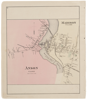
Anson Village, Madison Village
Athens, Athens Village, Palmyra Village
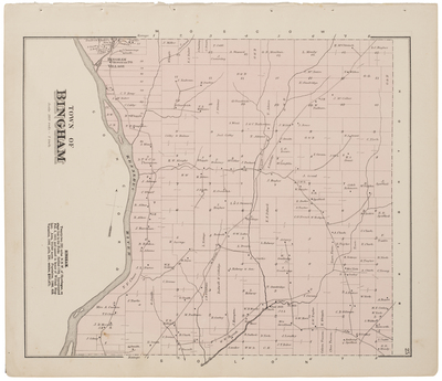
Bingham
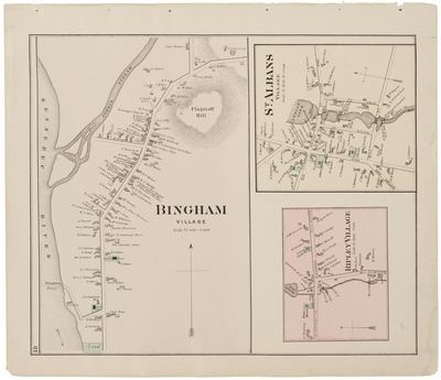
Bingham, St Albans, Ripley Village
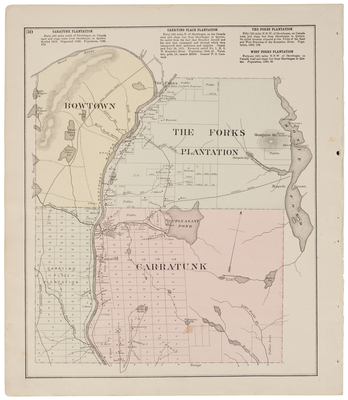
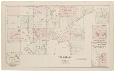
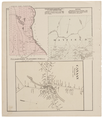
Bow Town, Carrying Place Plantation, The Forks Plantation & Carratunk
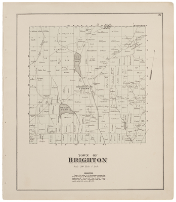
Brighton
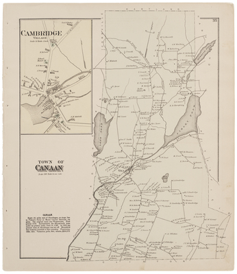
Cambridge & Canaan
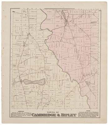
Cambridge & Ripley
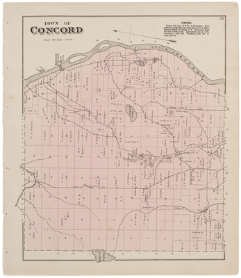
Concord
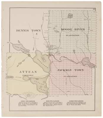
Dennis Town, Attean Township, Moose River Plantation & Jackman Town Plantation
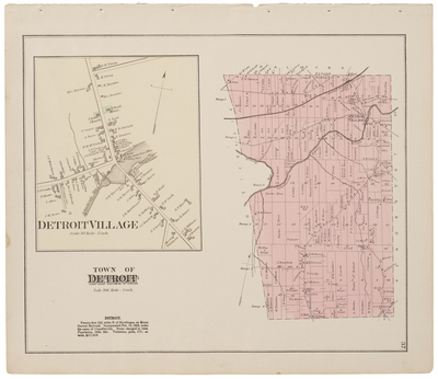
Detroit incl. street map
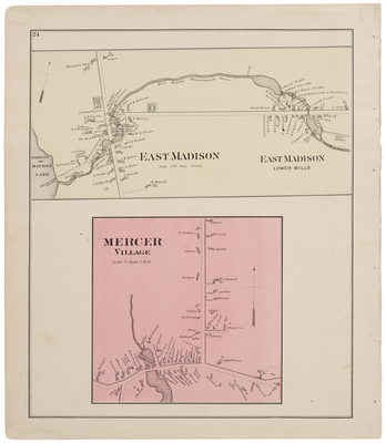
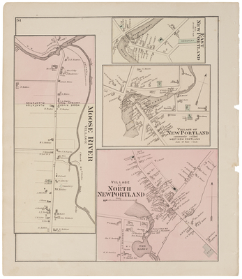
East Madison, East Madison lower mills & Mercer Village
Embden
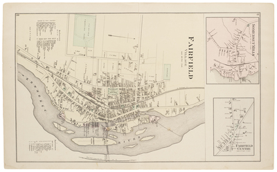
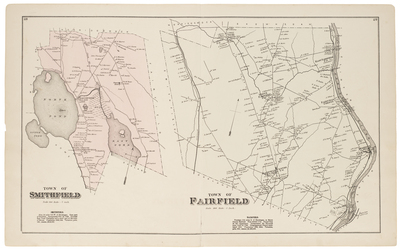
Fairfield, Somerset Mills & Fairfield Centre
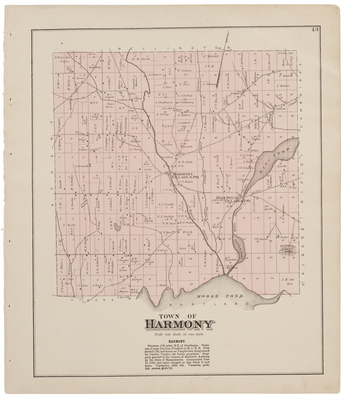
Harmony
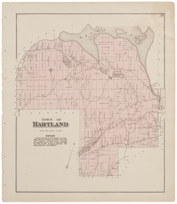
Hartland
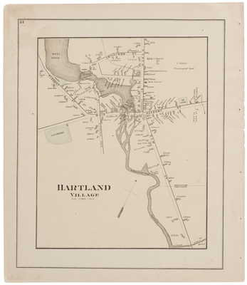
Hartland Village
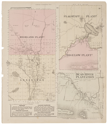
Highland Plantation, Lexington, Flagstaff Plantation, Bigelow Plantation & Dead River Plantation
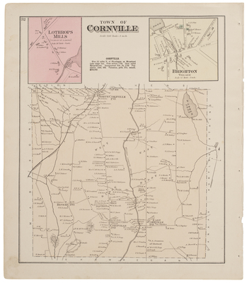
Lothrops Mills, Cornville & Brighton Village (street map)
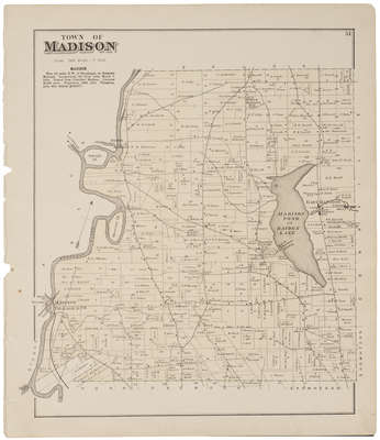
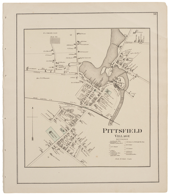
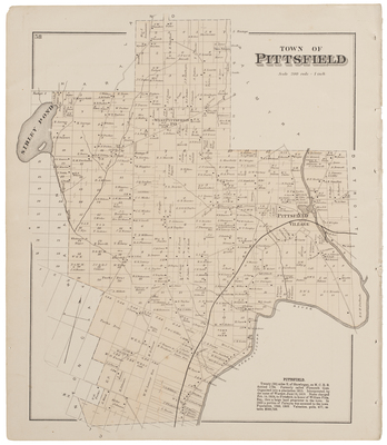
Madison
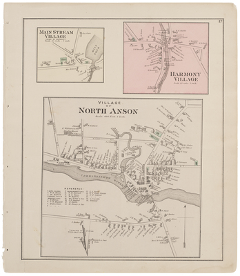
Main Stream Village (Harmony), Harmony Village, North Anson
Map of Somerset County, Maine
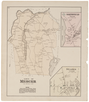
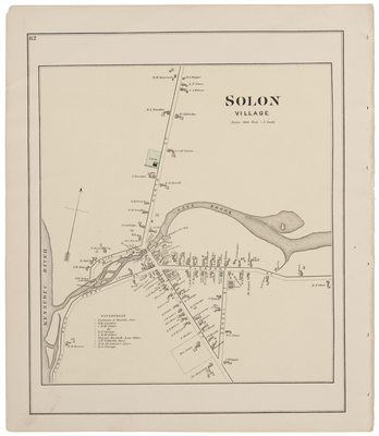
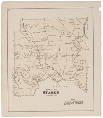
Mercer, Smithfield Village & Starks Village
1
2
Search
Enter search terms:
Select context to search:
in this collection
Digital Maine
Advanced Search
Notify me via email or
RSS
Browse
State Agencies
Subjects
Contributors
For Agency Contributors
FAQs
Featured Links
Maine Government
Maine State Library
Maine State Agencies
Digital Maine Partners
Gallery Locations
View gallery on map
View gallery in Google Earth


")

, Harmony Village, North Anson")

