

Preview
Contributing Institution
Maine State Archives
Document Type
Image
Identifier
65-207967-I001
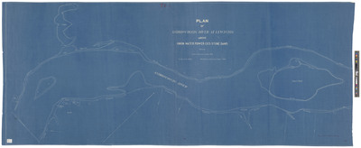
Description
Plan of Androscoggin River at Lewiston above Union Water Power Company's Stone Dams showing contours from elev. 67.00 to 76.00. Scale 1 inch=100 feet. Blueprint, approximately 28 x 70 inches.
Broad Creation Date
ca. 1910
Dimensions
71 x 178 inches
Language
English
Location
Androscoggin County; Lewiston
Other Location
Boxer's Island, Lewiston, Maine