• Home
  • Search
  • Browse State Agencies
  • My Account
  • About
  • DC Network Digital Commons Network™
Skip to main content
Digital Maine Maine State Library
  • Home
  • About
  • FAQs
  • My Account

Home > StateDocs > sos > ARCHIVES > ARC_IMG > ARC_DOC > MSA_EXHIBITS > ARC_200_EXHIBIT > ARC_200_EXHIBIT_CARTOGRAPHY

Maine: From District to Statehood

Cartography

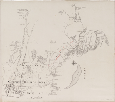
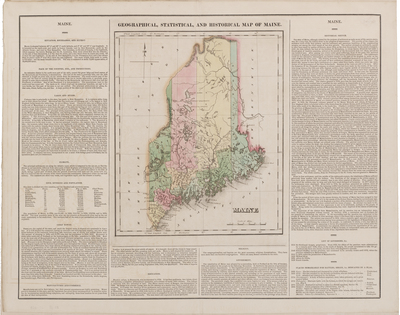
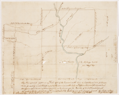
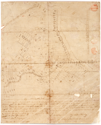
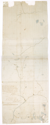
Map-making was very important in the early days of statehood. When Maine separated from Massachusetts, it was not a clean break. Massachusetts still owned some parts of Maine for many years after statehood was granted, and maps were important to distinguish these parcels of land. Much of northern Maine was still forest land and had not been explored; Maine would establish a Land Agent who was responsible for exploring this land and he sent many surveyors to do this work. The maps on display here are from the collection of Land Office maps and were completed by both the Land Agent’s surveyors and surveyors from Massachusetts.
Printing is not supported at the primary Gallery Thumbnail page. Please first navigate to a specific Image before printing.

Follow

Switch View to List View Slideshow
 
  • BMC 53--Massachusetts and Provinces of New Hampshire and Maine, circa 1760

    BMC 53--Massachusetts and Provinces of New Hampshire and Maine, circa 1760

  • BMC 56--Geographical, Statistical, and Historical Map of Maine, 1826 by Henry Charles Carey and Isaac Lea

    BMC 56--Geographical, Statistical, and Historical Map of Maine, 1826

  • BMC 55--The Province of Maine From the Best Authorities, 1794 by Samuel Lewis

    BMC 55--The Province of Maine From the Best Authorities, 1794

  • Page 07. Plan of 19,520 acres of land located out of the Commonwealth lands in eight thousand acres for Ebenezer Weston for making a road through a part of the Commonwealth land and eleven thousand five hundred twenty acres equal to one half townships of six miles square for the Proprietors of the half Township granted for making the County road through Dixmont and No. 2 located by order of the Surveyor General by Andrew Strong

    Page 07. Plan of 19,520 acres of land located out of the Commonwealth lands in eight thousand acres for Ebenezer Weston for making a road through a part of the Commonwealth land and eleven thousand five hundred twenty acres equal to one half townships of six miles square for the Proprietors of the half Township granted for making the County road through Dixmont and No. 2 located by order of the Surveyor General

  • Page 01.5. A Map and Chart of the Bays, Harbours, Post Roads, and Settlements in Passamaquoddy and Machias with the large Island of Grand Manan, 1810 by B. R. Jones

    Page 01.5. A Map and Chart of the Bays, Harbours, Post Roads, and Settlements in Passamaquoddy and Machias with the large Island of Grand Manan, 1810

  • Page 07. Plan of Bangor, 1801 by Park Holland

    Page 07. Plan of Bangor, 1801

  • Page 41. Plan representing the River Penobscott from a Pine Tree marked on the East Side of said river about 3.5 mile southward of Old Lammon Stream by Park Holland

    Page 41. Plan representing the River Penobscott from a Pine Tree marked on the East Side of said river about 3.5 mile southward of Old Lammon Stream


Search

Advanced Search

  • Notify me via email or RSS

Browse

  • State Agencies
  • Subjects
  • Contributors

For Agency Contributors

  • FAQs

Featured Links

  • Maine Government
  • Maine State Library
  • Maine State Agencies
  • Digital Maine Partners

Gallery Locations

  • View gallery on map
  • View gallery in Google Earth
 
Elsevier - Digital Commons

Home | About | FAQ | My Account | Accessibility Statement

Privacy Copyright