Home
Search
Browse State Agencies
My Account
About
Digital Commons Network™
Skip to main content
Home
About
FAQs
My Account
Home
>
Maine Communities
>
Surry, Maine
>
Surry Maps
Maps of Surry, Maine
Printing is not supported at the primary Gallery Thumbnail page. Please first navigate to a specific Image before printing.
Follow
Switch View
View Slideshow
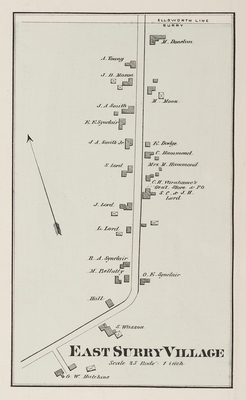
East Surry Village
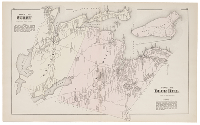
Surry, Blue Hill
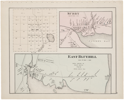
Township No.39, Surry, East Bluehill
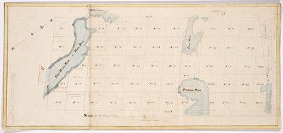
Page 19. Copy of a Plan of the Mortgaged land in the Town of Surry as the same was surveyed into lots by John Peters, Esq., Nov. 1822
Search
Enter search terms:
Select context to search:
in this collection
Digital Maine
Advanced Search
Notify me via email or
RSS
Browse
State Agencies
Subjects
Contributors
For Agency Contributors
FAQs
Links
Surry Historical Society
Featured Links
Maine Government
Maine State Library
Maine State Agencies
Digital Maine Partners
Gallery Locations
View gallery on map
View gallery in Google Earth


