

Preview
Contributing Institution
Scarborough Historical Society
Document Type
Image
Identifier
PN Library
Description
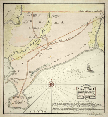
From the 1844 copy of a plan made by John Godsoe, Surveyor, for the use of the Supreme Court in the case of Prout and Trickey - June AD 1741.
The map shows houses, roads, and rivers south of a line between the Nonesuch River and the Spurwink River from about a mile north of the Black Point Road and Spurwink Road split.
Exact Creation Date
1844
Location
Cumberland County; Scarborough
Other Location
Black Point, Prouts Neck
Keywords
Map, Trickey, Prout