


Preview
Document Type
StillImage
Contributing Institution
Prince Memorial Library
Description
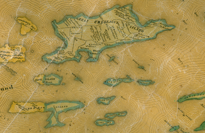
Chebeague and other islands section from Atlas of Cumberland County, Maine, was produced by J. Chace, Jr., Philadelphia in 1857. The original Cumberland County map is 145 x 150 cm., and includes statistics, vignettes of local buildings, inset maps of villages and towns, population statistics, table of distances, and local businesses.
Exact Creation Date
1857
Dimensions
69 cm x 45 cm
Language
English
Location
Cumberland County; Chebeague Island
Keywords
Cumberland; Maine; Atlases; Maps; Statistics; Population Statistics; Buildings; Businesses; Inset Maps; Tables