Home > StateDocs > sos > ARCHIVES > ARC_IMG > ARC_MAPS > PLANBOOK_MAPS > PLANBOOK_WALDO_COUNTY
Follow
Advanced Search


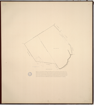
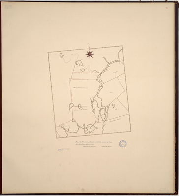
![Page 18. Plan of Township No. 4 First Range North of Waldo Patent [Troy]; 1792 by Ephraim Ballard](https://digitalmaine.com/planbook_waldo_county/1018/thumbnail.jpg "Page 18. Plan of Township No. 4 First Range North of Waldo Patent [Troy]; 1792 by Ephraim Ballard")

