

Preview
Contributing Institution
Maine State Archives
Document Type
StillImage
Identifier
302962
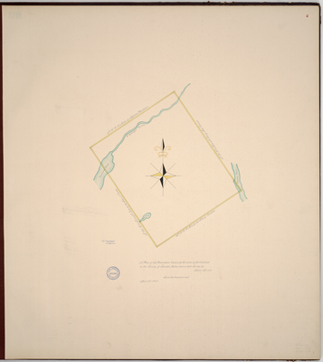
Description
Page 2 of Knox County planbook. Colored survey of Appleton by James Malcom using scale of 200 rods to an inch. Includes Sunibeck Pond [Sennebec Pond], St. George's River, Ram Pond, Canaan Pond [Megunticook Lake] and boundaries with New Canaan [Lincolnville], Union, and Camden. Copied from Massachusetts Archives Maps and Plans #2593. Notation on map "from Senate papers 1797, No. 2235."
Exact Creation Date
4-12-1797
Language
English
Location
Knox County; Appleton; Lincoln County
Other Location
Appleton Plantation, Maine
Keywords
Cartography; Maps; Maine Land Office; Planbooks; Surveys
Image Location
Rights Statement
No Copyright - United States. URI: http://rightsstatements.org/vocab/NoC-US/1.0/
The organization that has made the Item available believes that the Item is in the Public Domain under the laws of the United States, but a determination was not made as to its copyright status under the copyright laws of other countries. The Item may not be in the Public Domain under the laws of other countries. Please refer to the organization that has made the Item available for more information.