

Preview
Contributing Institution
Maine State Archives
Document Type
StillImage
Identifier
29424
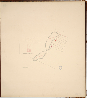
Description
Page 13 of the Kennebec County planbook. Survey of Dearborn, now Oakland, on a scale of 100 rods to one inch. Copied from Massachusetts Archives Maps and Plans #1765. Notation on map "from Act of Feb. 20, 1816, Land annexed to Waterville."
Exact Creation Date
1-9-1815
Language
English
Location
Kennebec County; Oakland
Other Location
Richardsons Mill Pond; Magraths Pond
Keywords
Cartography; Maps; Maine Land Office; Planbooks; Surveys