

Preview
Contributing Institution
Maine State Archives
Document Type
StillImage
Identifier
302961
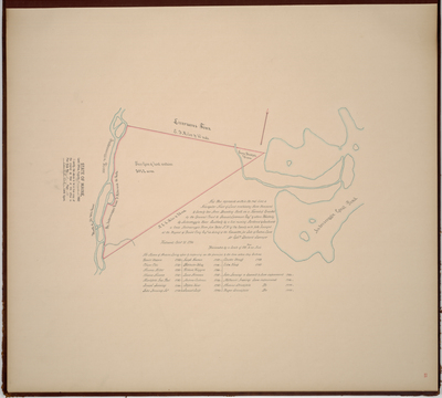
Description
Page 21 of the Androscoggin County planbook. Survey of land in Livermore on a scale of 100 rods to one inch. Lists names of settlers and date they settled the land.
Exact Creation Date
10-31-1794
Language
English
Location
Androscoggin County; Livermore
Keywords
Cartography; Maps; Maine Land Office; Planbooks; Surveys
Image Location
Rights Statement
No Copyright - United States. URI: http://rightsstatements.org/vocab/NoC-US/1.0/
The organization that has made the Item available believes that the Item is in the Public Domain under the laws of the United States, but a determination was not made as to its copyright status under the copyright laws of other countries. The Item may not be in the Public Domain under the laws of other countries. Please refer to the organization that has made the Item available for more information.