

Preview
Document Type
StillImage
Contributing Institution
Maine State Archives
Identifier
209714
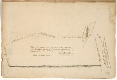
Description
Survey of land lying between Butterfield or No. 6 and a mountain containing 22,470 acres. Surveyed on scale of 200 rods to an inch.
Exact Creation Date
4-1786
Language
English
Location
Oxford County; Hartford
Other Location
Whitney Pond; Livermore
Keywords
Cartography; Maps; Maine Land Office; Planbooks; Surveys