

Preview
Document Type
StillImage
Contributing Institution
Maine State Archives
Identifier
209714
Description
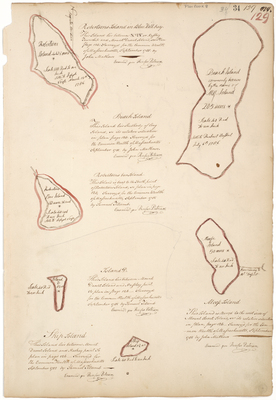
Plan of six islands in Blue Hill on a scale of 40 rods to an inch.
Exact Creation Date
9-1785
Language
English
Location
Hancock County; Blue Hill
Other Location
Robertsons Island; Beach Island; Robertsons Bar Island; Island D; Moose Island; Ship Island
Keywords
Cartography; Maps; Maine Land Office; Planbooks; Surveys