

Preview
Document Type
StillImage
Contributing Institution
Maine State Archives
Identifier
208461
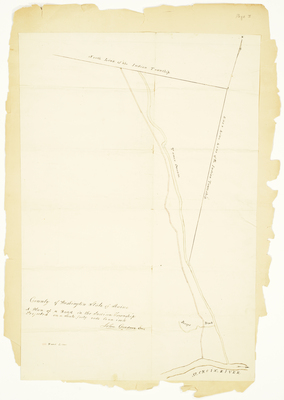
Description
Plan of a road in Indian Township near Tomer Stream.
Broad Creation Date
Unknown
Language
English
Location
Washington County; Indian Twp Res
Other Location
Tomer Stream; St. Croix River; Berrys Brook
Keywords
Cartography; Maps; Maine Land Office; Planbooks; Surveys