

Preview
Document Type
StillImage
Contributing Institution
Maine State Archives
Identifier
208462
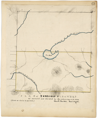
Description
Survey of T2 R4 WBKP (Tim Pond) on a scale of 40 chains to an inch.
Exact Creation Date
1870
Language
English
Location
Franklin County; Tim Pond Twp
Other Location
Kennebago River; Tim Pond; Dead River
Keywords
Cartography; Maps; Maine Land Office; Planbooks; Surveys