

Preview
Document Type
StillImage
Contributing Institution
Maine State Archives
Identifier
208384
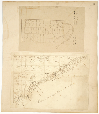
Description
East half of Plymouth Grant, R1 WELS (now Fort Fairfield) surveyed 1859 by Daniel Dennett.
Plan of T1 R8 West side Penobscot River.
Broad Creation Date
ca. 1859
Language
English
Location
Aroostook County; Fort Fairfield; Penobscot County; T1 R8 WELS
Keywords
Cartography; Maps; Maine Land Office; Planbooks; Surveys