

Preview
Document Type
StillImage
Contributing Institution
Maine State Archives
Identifier
208383
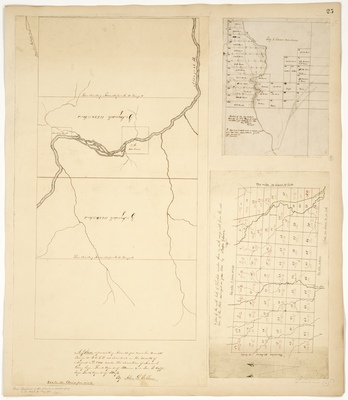
Description
A Plan representing Townships Number 14 and 15 Range 11 WELS as divided in the month of August A.D. 1850
Sketch of the North West Quarter of No. 3 Range 5 WELS as lotted for settlement 1861
A plan of the north half of Township number three in sixth range west from the east line of the State surveyed in June 1832. Now known as Staceyville.
Language
English
Location
Aroostook County; Sherman; T15 R11 WELS; T14 R11 WELS; Penobscot County; Stacyville
Keywords
Cartography; Maps; Maine Land Office; Planbooks; Surveys