

Preview
Document Type
StillImage
Contributing Institution
Maine State Archives
Identifier
208370
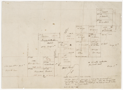
Description
Resurvey of the southeasterly and southwesterly part of River Township No. 2 (T2 R4 and T2 R5), also the survey of lots No. 51, 52, 53, 54, & 55 on a scale of 100 rods to the inch.
Exact Creation Date
9-1833
Language
English
Location
T2 R4 WELS; Silver Ridge Twp; Aroostook County
Keywords
Cartography; Maps; Maine Land Office; Planbooks; Surveys