

Preview
Document Type
StillImage
Contributing Institution
Maine State Archives
Identifier
298409
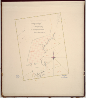
Description
Survey of easterly boundary of Samuel Waldo's lands on a scale of 2 miles to one inch. Copied from Massachusetts Archives Maps and Plans #777 and #885.
Exact Creation Date
8-1767
Language
English
Location
Hancock County; Waldo County; Frankfort
Other Location
Penobscot River; Cape Jellison; Fort Pownal
Keywords
Cartography; Maps; Maine Land Office; Planbooks; Surveys