

Preview
Document Type
StillImage
Contributing Institution
Maine State Archives
Identifier
298409
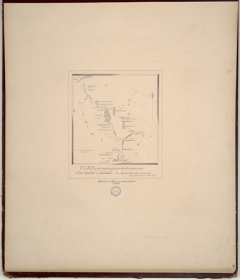
Description
Plan of the interior parts of the Country from Penobscot to Quebec. Explorative map for a road to Quebec on a scale of 25 miles to one inch. Begins at mouth of Penobscot River near Belfast and Fort Pownall to the Chaudiere River and the French settlement called Novelle.
Copied from Massachusetts Archives Maps and Plans #762. Field notes located #29462.
Exact Creation Date
1762
Language
English
Location
Penobscot County
Other Location
Penobscot River; Chaudiere River
Combo.pdf (9736 kB)
Journal of Survey from Fort Pownall to Quebec
Transc Journal Ft. Pownal to Quebec TP.pdf (373 kB)
Transcript of Chadwick's field notes
Journal of Survey from Fort Pownall to Quebec
Transc Journal Ft. Pownal to Quebec TP.pdf (373 kB)
Transcript of Chadwick's field notes
Keywords
Cartography; Maps; Maine Land Office; Planbooks; Surveys